Introducing Iranian Attractions
Introducing Iranian AttractionsIntroducing Iranian Attractions
Introducing Iranian AttractionsThe sights of iran-gilan
The sights of iran-gilan
The northern part of the province is part of territory of South (Iranian) Talysh. At the center of the province is the main city of Rasht. Other towns in the province include Astara, Astaneh-e Ashrafiyyeh, Fuman, Lahijan, Langrud, Masouleh, Manjil, Rudbar, Roudsar, Shaft, Talesh, and Soumahe Sara.
Geography and climate
Gilan has a humid subtropical climate with by a large margin the heaviest rainfall in Iran: reaching as high as 1,900 millimetres (75 in) in the southwestern coast and generally around 1,400 millimetres (55 in). Rasht, the capital of the province, is known internationally as the "City of Silver Rains" and within Iran as the "City of Rain". Rainfall is heaviest between September and December because the onshore winds from the Siberian High are strongest, but it occurs throughout the year though least abundantly from April to July. Humidity is very high because of the marshy character of the coastal plains and can reach 90 percent in summer for wet bulb temperatures of over 26 °C (79 °F). The Alborz range provides further diversity to the land in addition to the Caspian coasts.
The coastline is cooler and attracts large numbers of domestic and international tourists. Large parts of the province are mountainous, green and forested. The coastal plain along the Caspian Sea is similar to that of Mazandaran and mainly used for rice paddies. Due to successive cultivation and selection of rice by farmers, several cultivars including Gerdeh, Hashemi, Hasani, and Gharib have been bred.
Demographics
Gilan is overwhelmingly Gilaki, with a significant minority of Azerbaijanis and smaller groups of Georgians, Armenians, Circassians and others.
Five Iranian languages are spoken in Gilan — Gilaki, Rudbari and Taleshi and to a smaller extent Tati and Kurdish. All belong to the northwestern branch of Iranian languages. Non-Iranian languages are mainly Azerbaijani and to a greater extent Georgian, Armenian, Circassian, and some Gypsy (Romany). Three million people speak Gilaki as first or second language.
Culture
Gilan's position on the Tehran-Baku trade route has established the cities of Bandar-e Anzali and Rasht as ranking amongst the most important commercial centers in Iran. As a result, the merchant and middle classes comprise a significant percentage of the population.
The province has an annual average of 2 million tourists, mostly domestic. Although Iran's Cultural Heritage Organization lists 211 sites of historical and cultural significance in the province, the main tourist attraction in Gilan is the small town of Masouleh in the hills southeast of Rasht. The town is built similar to the Pueblo settlements, with the roof of one house being the courtyard of the next house above.
Gilan has a strong culinary tradition, from which several dishes have come to be adopted across Iran. This richness derives in part from the climate, which allows for a wide variety of fruit, vegetables and nuts to be grown in the province. Seafood is a particularly strong component of Gilani (and Mazandarani) cuisine. Sturgeon, often smoked or served as kebab, and caviar are delicacies along the whole Caspian littoral. Other types of fish such as mahi sefid, kuli, kulmeh, Caspian salmon, mahi kapur and many others are consumed. Fish roe, or ashpal, is widely used in Gileki cuisine. Traditional Persian stews such as ghalieh mahi (fish stew) and ghalieh maygu (shrimp stew) are featured and prepared in a uniquely Gilani fashion.
More specific to Gilan are a distinctive walnut-paste and pomegranate-juice sauce, used as a marinade for 'sour' kebab (Kabab Torsh) and as the basis of Fesenjān, a rich stew of duck, chicken or lamb. Mirza ghasemi is an aubergine and egg dish with a smoky taste that is often served as a side dish or appetizer. Other such dishes include pickled garlic, olives with walnut paste, and smoked fish. The caviar and smoked fish from the region are widely prized and sought-after specialties in domestic and foreign gourmet markets. See also Cuisine of Iran.
Languages
The Gilaki language is a Caspian language, and a member of the northwestern Iranian language branch, spoken in Iran's Gīlān Province.Gilaki is one of the main languages spoken in the province of Gilan and is divided into three dialects: Western Gilaki, Eastern Gilaki, and Galeshi (in the mountains of Gilan). The western and eastern dialects are separated by the Sefid River. Although Gilaki is the most widely spoken language in Gilan, the Talysh language and Azerbaijani language is also spoken in the province. There are only two cities in Gilan where Talyshi is exclusively spoken: Masal and Masoleh (although other cities speak Talyshi alongside Gilaki or Azeri) while Azeribaijani is spoken mostly in the city of Astara, Iran and surrounding towns. The Tati language (Iran) is spoken in the city of Rudbar. Persian is also spoken in the province of Gilan as it is Iran's officials language, requiring everyone to know Persian.


Rice cultivation in Gilan


The anzali talab


The road asalem to kalkal


Camkale

Dorfak

Sheytan kouh

Sobatan

Sarvlat

The lake os barreh sarvistan

Masall

The koleshtar area

Salansar

Rasht

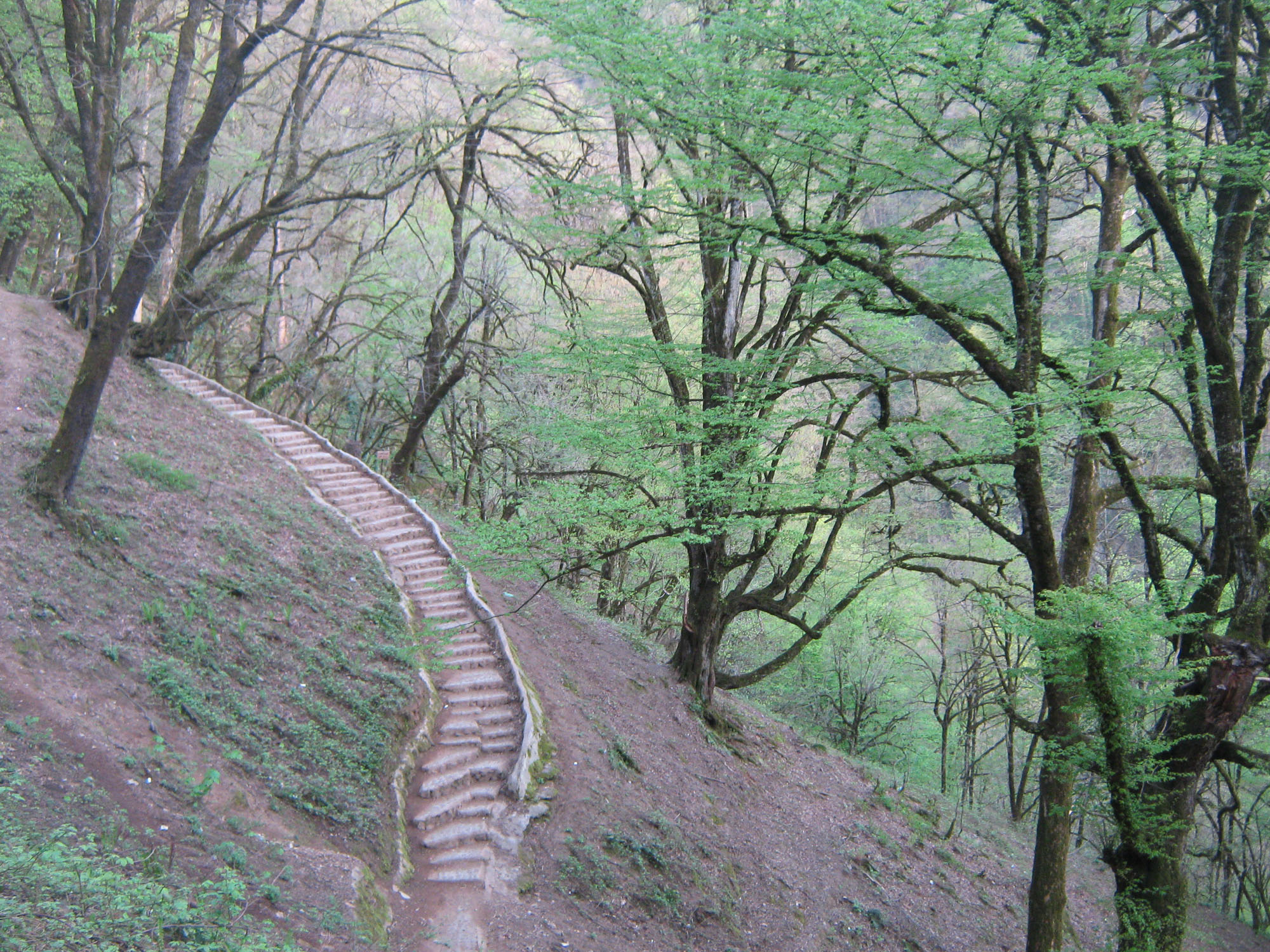
Gal.e roudkhan


Masouleh


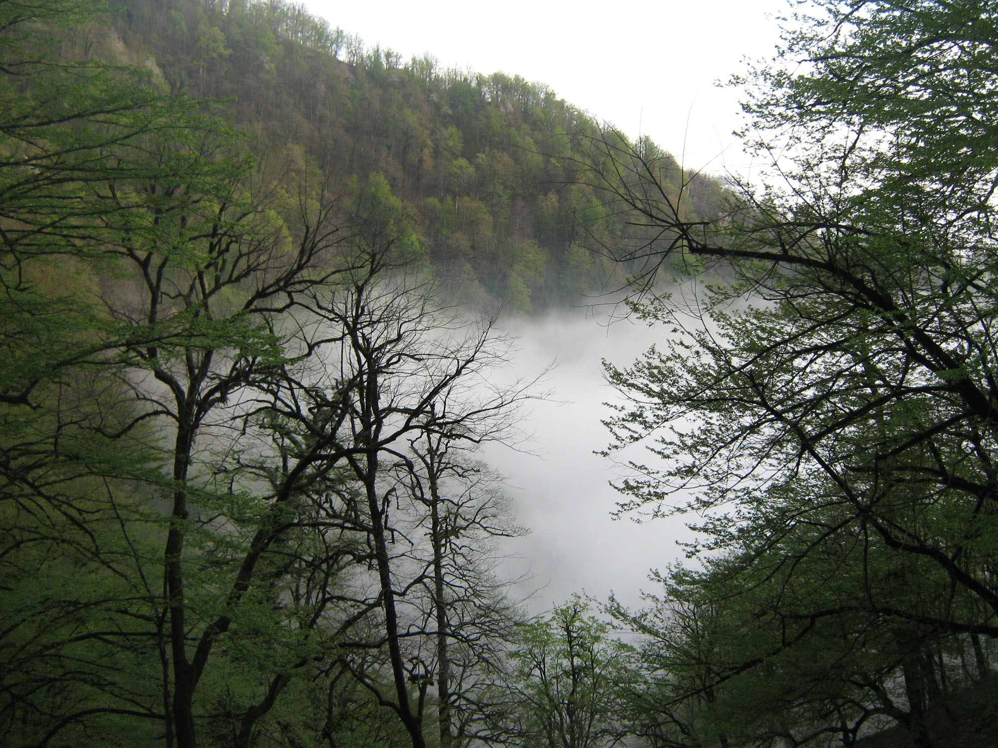
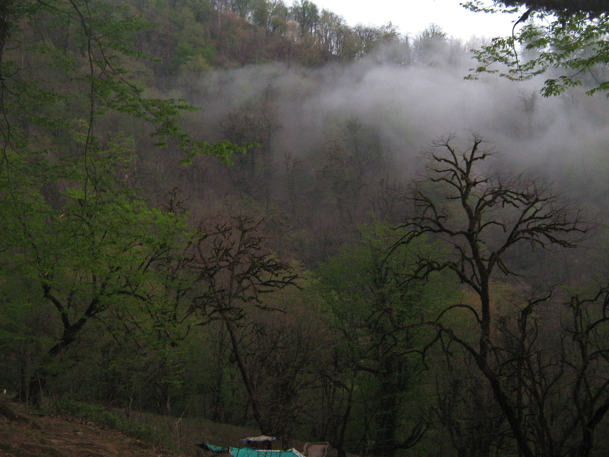
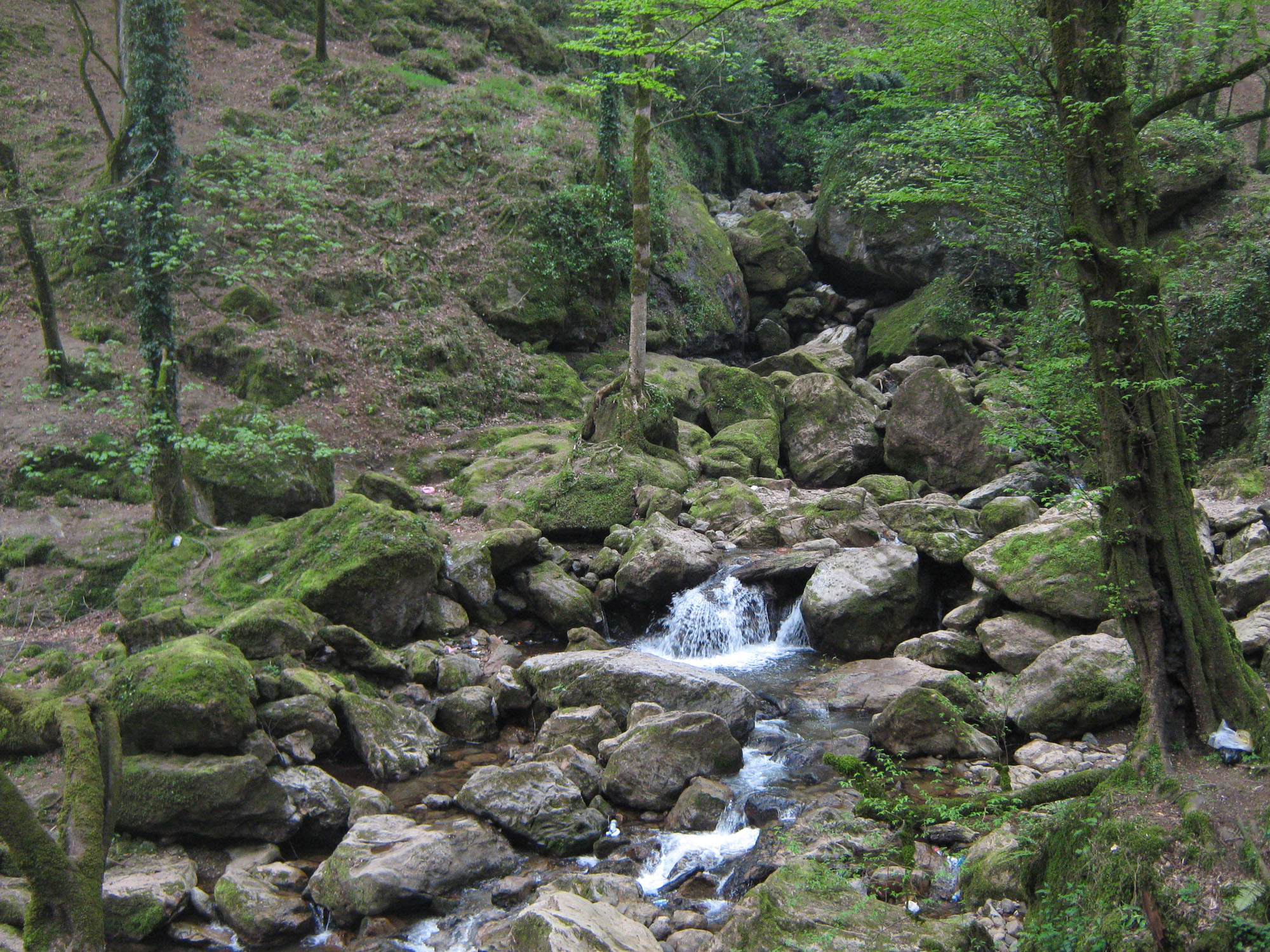
The gilan natur


Gilan_lahijan
Tea cultivation in Lahijan, Gilan


The sights of iran_gom
The sights of iran_gom
Qom is considered holy by Shiʿa Islam, as it is the site of the shrine of Fatimah bint Musa, sister of Imam `Ali ibn Musa Rida (Persian Imam Reza, 789–816 AD). The city is the largest center for Shiʿa scholarship in the world, and is a significant destination of pilgrimage. Qom is famous for a Persian brittle toffee known as Sohan (Persian:سوهان), considered a souvenir of the city and sold by 2,000 to 2,500 “Sohan” shops.
Qom has developed into a lively industrial centre owing in part to its proximity to Tehran. It is a regional centre for the distribution of petroleum and petroleum products, and a natural gas pipeline from Bandar Anzali and Tehran and a crude-oil pipeline from Tehran run through Qom to the Abadan refinery on the Persian Gulf. Qom gained additional prosperity when oil fields were discovered at Sarajeh near the city in 1956 and a large refinery was built between Qom and Tehran.
Geography
Qom, the capital of Qom province, is located 125 kilometers south of Tehran, on a low plain. The shrine of Fatima Masumeh, the sister of Imam Reza, is located in this city, which is considered by Shiʿa Muslims holy. The city is located in the boundary of the central desert of Iran (Kavir-e markazi). At the 2011 census its population was 1,074,036,comprising 545,704 men and 528,332 women.
Qom is counted as one of the focal centers of the Shiʿa both in Iran and around the globe. Since the revolution, the clerical population has risen from around 25,000 to more than 45,000 and the non-clerical population has more than tripled to about 700,000. Substantial sums of money in the form of alms and Islamic taxes flow into Qom to the ten marja-i taqlid or "Source of Imitation" that reside there. The number of seminary schools in Qom is now over fifty, and the number of research institutes and libraries somewhere near two hundred and fifty.
Its theological center and the Fatima Masumeh Shrine are prominent features of Qom. Another very popular religious site of pilgrimage formerly outside the city of Qom but now more of a suburb is called Jamkaran. Qom’s proximity to Tehran has allowed the clerical establishment easy access to monitor the affairs and decisions of state. Many Grand Ayatollahs possess offices in both Tehran and Qom; many people simply commute between the two cities as they are only 156 kilometres or 97 miles apart. Southeast of Qom is the ancient city of Kashan. Directly south of Qom lie the towns of Delijan, Mahallat, Naraq, Pardisan City, Kahak, and Jasb. The surrounding area to the east of Qom is populated by Tafresh, Saveh, and Ashtian and Jafarieh.
Climate
Qom has a hot desert climate (Köppen BWh) with low annual rainfall due to remoteness from the sea and being situated in the vicinity of the subtropical anticyclone aloft. Summer weather is very hot and essentially rainless, whilst in winter weather can vary from warm to – when Siberian air masses are driven south across the Elburz Mountains by blocking over Europe – frigid. An example of the latter situation was in January 2008 when minima fell to −23 °C or −9.4 °F on the 15th, whilst earlier similar situations occurred in January 1964 and to a lesser extent January 1950, January 1972 and December 1972.
Except for its hot and extremely dry summers, which are due to the city’s relatively low altitude among the hottest in inland Iran, all seasons are suitable for travelling to Qom.
The holy shrin_hazrat masoumeh


The jamkaran mosque


The river gomroud

The algadir mosque

Imamzadeh ahmad

The parsia big hotel

The gom big timgheh

The hashemi park

Handicrafts

Souvenir qom(sohan)

Moharram ceremony of Ashura


The sult lake


The sights of iran-mazandaran
The sights of iran-mazandaran
Mazandaran Province About this sound pronunciation (help·info), (Persian: استان مازندران Ostān-e Māzandarān/Ostâne Mâzandarân), is an Iranian province located along the southern coast of the Caspian Sea and in the adjacent Central Alborz mountain range, in central-
Geography and population
Geography
Mazandaran is located on the southern coast of the Caspian Sea. It is bordered clockwise by Golestan, Semnan and Tehran provinces.[27] This province also borders Qazvin and Gilan to the west. Mazandaran province is geographically divided into two parts: the coastal plains, and the mountainous areas. The Alborz Mountain Range surrounds the coastal strip and plains of the Caspian Sea.
From the geographical point of view, Mazandaran province is divided into two parts i.e. coastal plain and the mountainous area. The Alborz Mountain Range like a huge wall has surrounded the coastal strip and plains of the Caspian Sea. Due to permanent sea breez and local winds of the southern and eastern coasts of the Caspian Sea, sandy hills are formed, causing the appearance of a low natural barrier between the sea and plain
Climate
It has a variety of climates, including the mild and humid climate of Caspian shoreline and the moderate and cold climate of mountainous regions.ience the mild climate of the Caspian region. In the 1,500- to 3,000-meter altitudes, there is a moderate mountainous climate, with long, cold winters, and short, mild summers. In this region, snow covers parts of the province even up to the middle of the warm season. In fact, snow can be observed in this region even in the warmest months of the year.
Tourism
Over 15 million Iranian and some 400,000 foreign tourists visit the province annually. More than 800 registered historical and cultural sites, 338 kilometers of shorelines, mineral springs in jungles and mountains, waterfalls, and caves are among the major tourism attractions in the Mazandaran province.


Motel gou


Mazandaran_savadkouh (bridge veresk)


Damavand moutain

The farah abad mosque

The ramsar palace

The babol musiem

Imam zadeh gasem

Haraz river

The rice husbandry champ


The natur of mazandaran


Namak abroud


The ab pari waterfall


The chalous road


The sights of iran-lorestan
The sights of iran-lorestan
Khorramabad About this sound pronunciation (help·info) (Persian: خرمآباد - also Romanized as Khorramābād, Khoramabad, Khurramabad, Khorram Abad and Khur Ramābād)[1] is a city in and capital of Lorestan Province, Iran. At the 2006 census, its population was 328,544, in 75,945 families. Khorramabad is situated in the Zagros Mountains. Khorramabad Airport is 3 km south of the city proper.
The city population is predominantly Lur and Lak, although the two groups are closely related.Although not a major tourist destination, it is quite scenic and possesses several attractions, such as 5 Paleolithic cave-dwelling sites. In the city center, a tall citadel called Falak-ol-Aflak (The Heaven of Heavens), a relic of the Sassanid era, is now a nationally popular museum.
Economically, it is the regional base of the agricultural industry.
Khorramabad has what is classed under the Köppen climate classification as a semi-arid (BSh) with continental influences, owing to its high altitude making it much wetter than lowland cities like Baghdad or cities more shielded from the Zagros Mountains like Esfahan and Tehran. It remains extremely hot in the summer even with very low humidity, but the winter is sufficiently wet for rainfed agriculture.
Main sights
Falak-ol-Aflak Castle
Falak-ol-Aflak Castle, Dež-e Shāpūr-Khwāst, Falak-ol-Aflak Castle, in ancient times was known as Dezbaz as well as Shapur-Khast, is one of the most impressive castles in Iran. It is situated on the top of a large hill with the same name within the city of Khorramabad, the regional capital of Lorestan province. The Khorramabad River runs past the eastern and south-western side of the Falak-ol-Aflak hill providing the fortress with an element of natural protection. Today, the western and northern sides of the hill are bordered by the residential districts of Khorramabad. This gigantic structure was built during the Sassanid era (226–651). It has been known by a number of names since it was built over 1800 years ago. Recorded names have referred to it as Shapur-Khast or Sabr-Khast fortress, Dezbaz, Khorramabad castle, and ultimately the Falak ol-Aflak Castle. The foundations of the actual castle measure approximately 300 meters by 400 meters. The height of the entire structure, including the hill, reaches up to 40 meters above the surrounding area. This space is divided into four large halls, and their associated rooms and corridors. The rooms all surround two courtyards with the following measurements: the first courtyard measures 31×22.50 meters and the second 29x21 meters. . When originally built the castle used to have 12 towers, but only 8 remain standing today. The building's entrance is situated towards the north, within the body of the north-western tower.
Gerdab sangi
Gerdab Sangi is located in Takhti Square in Khorramabad, Lorestan and is made of stones and plaster. It dates back to the Sassanid era (224-651 CE) and is a circular whirlpool built for the purpose of accurate and optimal distribution of water. Encircling several springs, the edifice sits near the prehistoric Qomri Cave. The construction was once used for rationing and distributing potable and agricultural water among local population and farmers. Its surrounding cylindrical stone wall has a height of 10 meters and a diameter of 18 meters. There are a few different-sized outlets in the wall for controlling the flow of water into a canal on the west of the structure. While originally there were 7 of such outlets, however, today only one is functional. This outlet measures 160 x 90 centimeters and opens and closes like a drawer. The water flowing out of this outlet, after a path of approximately 12 kilometers, would eventually make its way to a valley called Baba Abbas. In the vicinity of this valley, and the location of the ancient city of Shapurkhast, the remnants of an old mill, which was run using water from the springs, can be observed. Gerdab Sangi was registered on the National Heritage List in 1976.
Brick minaret
Brick Minaret is a 900-year-old brick tower located beside the ancient city of Shapur khawst, south of Khorramabad, Lorestan province. It was built as a guidepost for caravans in ancient times. The minaret is about 30 meters tall with a circumference of 17.5 meters. Inside the tower there is a spiral staircase of 99 stairs.
In a stone-edged circle beside thundering Shari’ati St is an inscribed stone from around AD 1150, apparently setting out details of local grazing rights.


The korram abad airport

Shapouri bridge

Shapouri castle

Sarbazkaneh bullding


Lagon poldoktar


The soltani mosque

The falakolaflak castle

The Q lake


The lorestan at night

The waterfall great

The nozian waterfall

The bisheh waterfall


The sights of iran-geshm island
The sights of iran-geshm island
Qeshm (Persian: قشم, Persian pronunciation: [ɢeʃm]), formerly also known as Kishm, is an Iranian island in the Strait of Hormuz, separated from the mainland by the Clarence Strait/Khuran in the Persian Gulf (26°50′N 56°0′E). It is the largest island in Iran.
Geography
Qeshm Island is located a few kilometers off the southern coast of Iran (Persian Gulf), opposite the port cities of Bandar Abbas and Bandar Khamir. The island, which hosts a 300-square-kilometre (116-square-mile) free zone jurisdiction, is 135 km long, and lies strategically in the Strait of Hormuz, just 60 kilometres (37 miles) from the Omani port of Khasab, and about 180 kilometres (112 miles) from the UAE Port Rashid. The island, at its widest point, located near the center of the island, spans 40 kilometres (25 miles). Similarly, at it narrowest point, the island spans 9.4 kilometres (5.8 miles). The island has a surface area of 1,491 square kilometres (576 square miles) and is 2.5 times the size of Bahrain. Qeshm city, located at the easternmost point of the island, is 22 kilometres (14 miles) from Bandar Abbas while the closest point of the island is but two kilometres (1 mile) from the mainland.
The average temperature on the island is approximately 27 °C (81 °F). The warmest months are June through August, and the coldest from October to January. The average rainfall is 183.2 mm (7 3⁄16 in).
The island comprises 59 towns and villages and the population was 117,774 at the 2011 Census. The local population is involved in fishing, dhow construction, trade and services. An additional 30,000 are involved in administrative and industrial workforce and students.
Plans have also been made to build a bridge to connect Qeshm with the rest of Iran
History
Tomb stone in Portuguese castle, Qeshm
Historical records concerning the Qeshm island date far back into the pre-Islamic era. Names as Qeshm, Keshm, Kish and Tunb mark the lengthy stay of Ilamids in the area, several centuries BC. It is, apparently, the island called Alexandria or Aracia by Ptolemy (Book 6, Chap. IV), in the 2nd century CE and as Alexandria by Ammianus Marcellinus (xxiii.6.42) in the 4th century. On account of its strategic geopolitical situation, near the mouth of the Persian Gulf, it has been frequently attacked by invaders including Ilamids (Elamites), Umayyads, Abbasids as well as the Portuguese and the English. During Sassanian Empire administration the island was called Abarkawan. According to historical records, Qeshm Island has been famous as a trade and navigation center. Its economy flourished during the Dailamites and Buyid eras, as trade vessels sailed between Qeshm Island and China, India and Africa.
Explorer William Baffin was mortally wounded on Qeshm in 1622 during a battle against Portuguese forces who occupied the fort, known to the English as "Forte de Queixome".
Qeshm is also a supposed site of the Garden of Eden according to Cassells Bible
Economy
Fishing is a leading occupation practiced by the inhabitants of the island. On what little cultivated land there is, dates and melons are grown. Salt is mined on the southeastern coast. Qeshm is famous for its wide range of ecotourist attractions such as the Hara marine forests. According to environmentalists, about 1.5% of the world birds and 25% of Iran's native birds annually migrate to the forests, which are the first national geo park in Iran. An ancient Portuguese fort, historic mosques, the Seyyed Mozaffar and Bibi Maryam shrines, and various ponds and mangrove forests are among the tourism attractions in the island, which lays across the azure waters of the Persian Gulf. Several domes, salty caves, the preserved area in Shibderaz Village where Hawksbill turtles hatch, as well as numerous docks and wharfs are among the tourist potentials of the island. The Nazz Islands are located at the south wing of Qeshm Island. Oysters, corals, colorful fishes and sea birds in these islands attract many tourists. It is possible to walk toward the island on soft and wet gravel through a gravel connection way between these islands and Qeshm at the time of the ebb.
Iran Air Flight 655
On 3 July 1988, an Iran Air Airbus A300 (Iran Air Flight 655) was shot down by a United States Navy guided missile cruiser USS Vincennes just south of the island, resulting in 290 civilian fatalities. The wreckage crashed 2.5 kilometers off Qeshm's southern coast.
Military Facility
On 20 January 2012, OSGEOINT established the completion of an underground military facility at Qeshm island which accordingly could house Iran's Ghadir-Nahang class submarines
Economy, culture, and education
Qeshm Institute of Higher Education
Islamic Azad University of Medical Science Qeshm International Branch
Geshm_hengam island


Harra jungle


The natur of geshm


Geshm_naz ialand

Persian gulf sea
