Introducing Iranian Attractions
Introducing Iranian AttractionsIntroducing Iranian Attractions
Introducing Iranian AttractionsThe sights of iran-kermanshah
The sights of iran-kermanshah
Climate
Kermanshah has a climate which is heavily influenced by the proximity of the Zagros mountains, classified as a hot-summer Mediterranean climate (Csa). The city's altitude and exposed location relative to westerly winds makes precipitation a little bit high (more than twice that of Tehran), but at the same time produces huge diurnal temperature swings especially in the virtually rainless summers, which remain extremely hot during the day. Kermanshah experiences rather cold winters and there are usually rainfalls in fall and spring. Snow cover is seen for at least a couple of weeks in winter.
Sightseeing
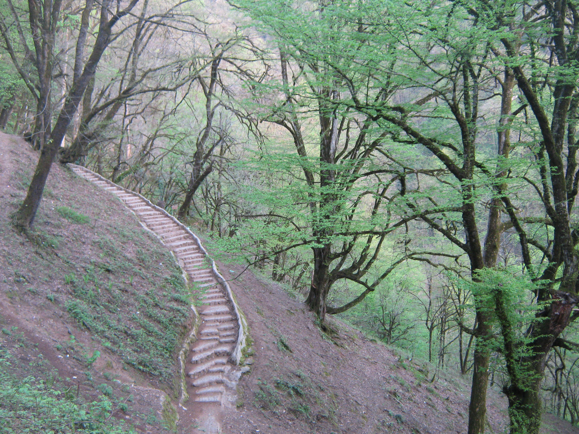
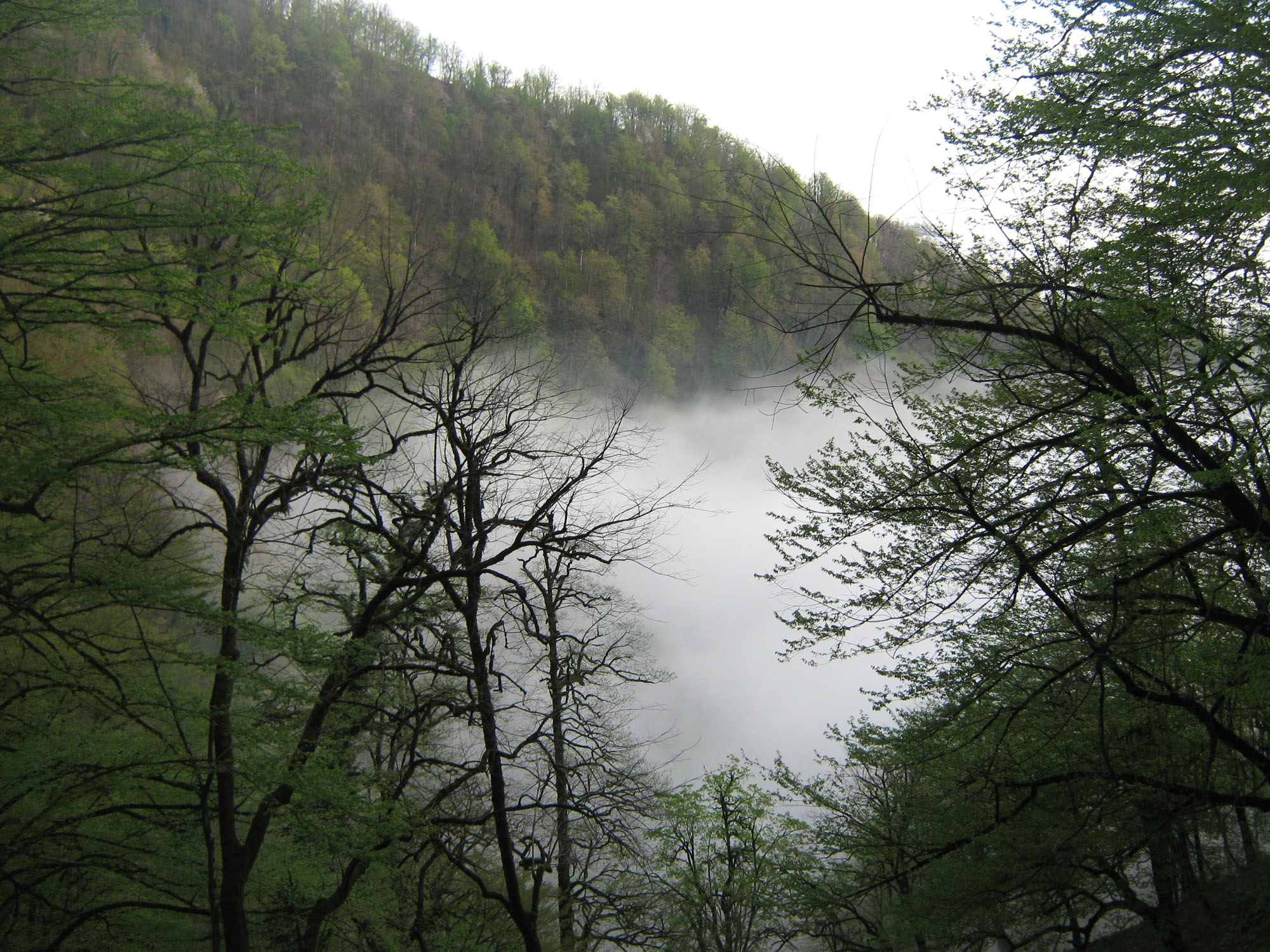
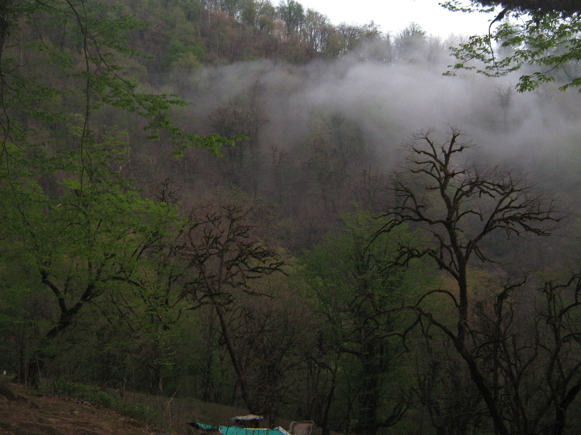
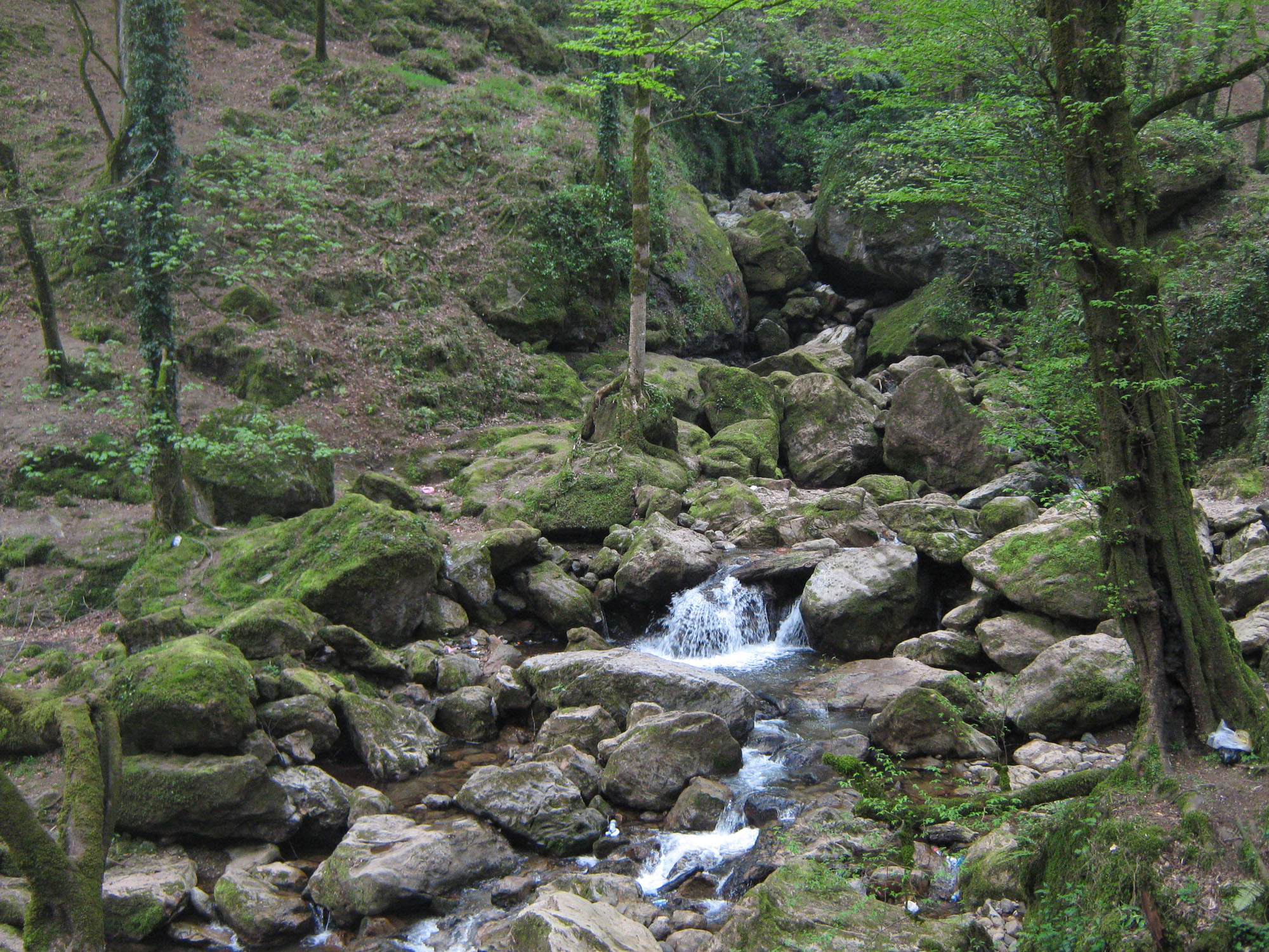
Kermanshah sights include Kohneh Bridge, Behistun Inscription, Taghbostan, Temple of Anahita, Dinavar, Ganj Dareh, Essaqwand Rock Tombs, Sorkh Deh chamber tomb, Malek Tomb, Hulwan, Median dakhmeh (Darbad, Sahneh), Parav cave, Do-Ashkaft Cave, Tekyeh Moaven al-molk, Dokan Davood Inscription, Sar Pol-e-Zahab, Tagh e gara, Patagh pass, Sarab Niloufar, Ghoori Ghale Cave, Khajeh Barookh's House, Chiyajani Tappe, Statue of Herakles in Behistun complex, Emad al doleh Mosque, Tekyeh Biglarbeigi, Hunters cave, Jamé Mosque of Kermanshah, Godin Tepe, Bas relief of Gotarzes II of Parthia, and Anobanini bas relief.
Tagh bostan
Main article: Taq-e_Bostan
Taghbostan is a series of large rock reliefs from the era of Sassanid Empire of Persia, the Iranian dynasty which ruled western Asia from 226 to 650 AD. This example of Sassanid art is located 5 km (3 mi) from the city center of Kermanshah in western Iran. It is located in the heart of the Zagros mountains, where it has endured almost 1,700 years of wind and rain.
The carvings, some of the finest and best-preserved examples of Persian sculpture under the Sassanids, include representations of the investitures of Ardashir II (379–383) and Shapur III (383–388). Like other Sassanid symbols, Taghbostan and its relief patterns accentuate power, religious tendencies, glory, honor, the vastness of the court, game and fighting spirit, festivity, joy, and rejoicing.
Sassanid kings chose a beautiful setting for their rock reliefs along an historic Silk Road caravan route waypoint and campground. The reliefs are adjacent a sacred spring that empties into a large reflecting pool at the base of a mountain cliff.
Taghbostan and its rock relief are one of the 30 surviving Sassanid relics of the Zagros mountains. According to Arthur Pope, the founder of Iranian art and archeology Institute in the USA, "art was characteristic of the Iranian people and the gift which they endowed the world with."
One of the most impressive reliefs inside the largest grotto or ivan is the gigantic equestrian figure of the Sassanid king Khosrau II (591-628 AD) mounted on his favorite charger, Shabdiz. Both horse and rider are arrayed in full battle armor. The arch rests on two columns that bear delicately carved patterns showing the tree of life or the sacred tree. Above the arch and located on two opposite sides are figures of two winged angels with diadems. Around the outer layer of the arch, a conspicuous margin has been carved, jagged with flower patterns. These patterns are also found in the official costumes of Sassanid kings. Equestrian relief panel measured on 16.08.07 approx. 7.45 m across by 4.25 m high.
Behistun
Behistun inscription is considered as a UNESCO World Heritage Site. The Behistun Inscription (also Bisitun or Bisutun, Modern
Persian: بیستون ; Old Persian: Bagastana, meaning "the god's place or land") is a multi-lingual inscription located on Mount Behistun.
The inscription includes three versions of the same text, written in three different cuneiform script languages: Old Persian, Elamite, and Babylonian. A British army officer, Henry Rawlinson, had the inscription transcribed in two parts, in 1835 and 1843. Rawlinson was able to translate the Old Persian cuneiform text in 1838, and the Elamite and Babylonian texts were translated by Rawlinson and others after 1843. Babylonian was a later form of Akkadian: both are Semitic languages. In effect, then, the inscription is to cuneiform what the Rosetta Stone is to Egyptian hieroglyphs: the document most crucial in the decipherment of a previously lost script.
The inscription is approximately 15 metres high by 25 metres wide, and 100 metres up a limestone cliff from an ancient road connecting the capitals of Babylonia and Media (Babylon and Ecbatana). It is extremely inaccessible as the mountainside was removed to make the inscription more visible after its completion. The Old Persian text contains 414 lines in five columns; the Elamite text includes 593 lines in eight columns and the Babylonian text is in 112 lines. The inscription was illustrated by a life-sized bas-relief of Darius, holding a bow as a sign of kingship, with his left foot on the chest of a figure lying on his back before him. The prostrate figure is reputed to be the pretender Gaumata. Darius is attended to the left by two servants, and ten one-metre figures stand to the right, with hands tied and rope around their necks, representing conquered peoples. Faravahar floats above, giving his blessing to the king. One figure appears to have been added after the others were completed, as was (oddly enough) Darius' beard, which is a separate block of stone attached with iron pins and lead.
Qajar dynasty monuments
During the Qajar dynasty (1794 to 1925), Kermanshah Bazaar, mosques and tekyehs such as Moaven al-molk Mosque, and beautiful houses such as Khajeh Barookh's House were built.
Tekyeh Moaven al-molk is unique because it has many pictures on the walls that relate to shahnameh, despite some of its more religious ones.
Khajeh Barookh's House is located in the old district of Faizabad, a Jewish neighborhood of the city. It was built by a Jewish merchant of the Qajar period, named Barookh/Baruch. The house, an historical depiction of Iranian architecture, was renamed "Randeh-Kesh House", after the last owner, is a "daroongara"(inward oriented) house and is connected through a vestibule to the exterior yard and through a corridor to the interior yard. Surrounding the interior yard are rooms, brick pillars making the iwans(porches) of the house, and step-like column capitals decorated with brick-stalactite work. This house is among the rare Qajar houses with a private bathroom.
Bazars
Yahoudi-ha Bazar(Jewish Bazar) or (Islami Bazar) - It is one of the oldest shopping centers in Iran from Qajar period(1785–present) in which you can find traditional clothes, the Kurdish traditional cloth, miscellaneous spice, Giweh, hand made metal knife, hand made leather, and some blacksmith stores, and some stores which sell distilled water from medical plants and flowers.
The Kurds Bazar or (Tarikeh Bazar) - In this shopping center all kinds of jewelry and some special cookies like Nan Berenji Kaak and Naan Khormaei which are the famous souvenirs of Kermanshah are sold.
Economy
Kermanshah is one of the western agricultural core of Iran that produces grain, rice, vegetable, fruits, and oilseeds, however Kermanshah is emerging as a fairly important industrial city; there are two industrial centers with more than 256 manufacturing units in the suburb of the city. These industries include petrochemical refinery, textile manufacturing, food processing, carpet making, sugar refining, and the production of electrical equipment and tools. Kermanshah Oil Refining Company (KORC) established in 1932 by British companies, is one of the major industries in the city. After recent changes in Iraq, Kermanshah has become one of the main importing and exporting gates of Iran.
Flowers garden

Bistoun

Sarab sahneh

Tekye moavenolmolk

kangah village

Tag bostan

Anahita on the left as the patron yazata of the Sassanian dynasty behind Emperor Khosrau Parviz with Ahura Mazda presenting the diadem of sovereignty on the right. Taq-e Bostan.

Dariush Inscription
Big tag in tag bostan

Bostan stone Museum

Pearl Stone Museum of Zachares

Museum of Anthropology

Museum of clothing and ornaments

The mosque of shafe. iha


The paveh village


The souvenir of kermashah

The sights of iran-gilan
The sights of iran-gilan
The northern part of the province is part of territory of South (Iranian) Talysh. At the center of the province is the main city of Rasht. Other towns in the province include Astara, Astaneh-e Ashrafiyyeh, Fuman, Lahijan, Langrud, Masouleh, Manjil, Rudbar, Roudsar, Shaft, Talesh, and Soumahe Sara.
Geography and climate
Gilan has a humid subtropical climate with by a large margin the heaviest rainfall in Iran: reaching as high as 1,900 millimetres (75 in) in the southwestern coast and generally around 1,400 millimetres (55 in). Rasht, the capital of the province, is known internationally as the "City of Silver Rains" and within Iran as the "City of Rain". Rainfall is heaviest between September and December because the onshore winds from the Siberian High are strongest, but it occurs throughout the year though least abundantly from April to July. Humidity is very high because of the marshy character of the coastal plains and can reach 90 percent in summer for wet bulb temperatures of over 26 °C (79 °F). The Alborz range provides further diversity to the land in addition to the Caspian coasts.
The coastline is cooler and attracts large numbers of domestic and international tourists. Large parts of the province are mountainous, green and forested. The coastal plain along the Caspian Sea is similar to that of Mazandaran and mainly used for rice paddies. Due to successive cultivation and selection of rice by farmers, several cultivars including Gerdeh, Hashemi, Hasani, and Gharib have been bred.
Demographics
Gilan is overwhelmingly Gilaki, with a significant minority of Azerbaijanis and smaller groups of Georgians, Armenians, Circassians and others.
Five Iranian languages are spoken in Gilan — Gilaki, Rudbari and Taleshi and to a smaller extent Tati and Kurdish. All belong to the northwestern branch of Iranian languages. Non-Iranian languages are mainly Azerbaijani and to a greater extent Georgian, Armenian, Circassian, and some Gypsy (Romany). Three million people speak Gilaki as first or second language.
Culture
Gilan's position on the Tehran-Baku trade route has established the cities of Bandar-e Anzali and Rasht as ranking amongst the most important commercial centers in Iran. As a result, the merchant and middle classes comprise a significant percentage of the population.
The province has an annual average of 2 million tourists, mostly domestic. Although Iran's Cultural Heritage Organization lists 211 sites of historical and cultural significance in the province, the main tourist attraction in Gilan is the small town of Masouleh in the hills southeast of Rasht. The town is built similar to the Pueblo settlements, with the roof of one house being the courtyard of the next house above.
Gilan has a strong culinary tradition, from which several dishes have come to be adopted across Iran. This richness derives in part from the climate, which allows for a wide variety of fruit, vegetables and nuts to be grown in the province. Seafood is a particularly strong component of Gilani (and Mazandarani) cuisine. Sturgeon, often smoked or served as kebab, and caviar are delicacies along the whole Caspian littoral. Other types of fish such as mahi sefid, kuli, kulmeh, Caspian salmon, mahi kapur and many others are consumed. Fish roe, or ashpal, is widely used in Gileki cuisine. Traditional Persian stews such as ghalieh mahi (fish stew) and ghalieh maygu (shrimp stew) are featured and prepared in a uniquely Gilani fashion.
More specific to Gilan are a distinctive walnut-paste and pomegranate-juice sauce, used as a marinade for 'sour' kebab (Kabab Torsh) and as the basis of Fesenjān, a rich stew of duck, chicken or lamb. Mirza ghasemi is an aubergine and egg dish with a smoky taste that is often served as a side dish or appetizer. Other such dishes include pickled garlic, olives with walnut paste, and smoked fish. The caviar and smoked fish from the region are widely prized and sought-after specialties in domestic and foreign gourmet markets. See also Cuisine of Iran.
Languages
The Gilaki language is a Caspian language, and a member of the northwestern Iranian language branch, spoken in Iran's Gīlān Province.Gilaki is one of the main languages spoken in the province of Gilan and is divided into three dialects: Western Gilaki, Eastern Gilaki, and Galeshi (in the mountains of Gilan). The western and eastern dialects are separated by the Sefid River. Although Gilaki is the most widely spoken language in Gilan, the Talysh language and Azerbaijani language is also spoken in the province. There are only two cities in Gilan where Talyshi is exclusively spoken: Masal and Masoleh (although other cities speak Talyshi alongside Gilaki or Azeri) while Azeribaijani is spoken mostly in the city of Astara, Iran and surrounding towns. The Tati language (Iran) is spoken in the city of Rudbar. Persian is also spoken in the province of Gilan as it is Iran's officials language, requiring everyone to know Persian.


Rice cultivation in Gilan


The anzali talab


The road asalem to kalkal


Camkale

Dorfak

Sheytan kouh

Sobatan

Sarvlat

The lake os barreh sarvistan

Masall

The koleshtar area

Salansar

Rasht

Gal.e roudkhan


Masouleh


The gilan natur


Gilan_lahijan
Tea cultivation in Lahijan, Gilan